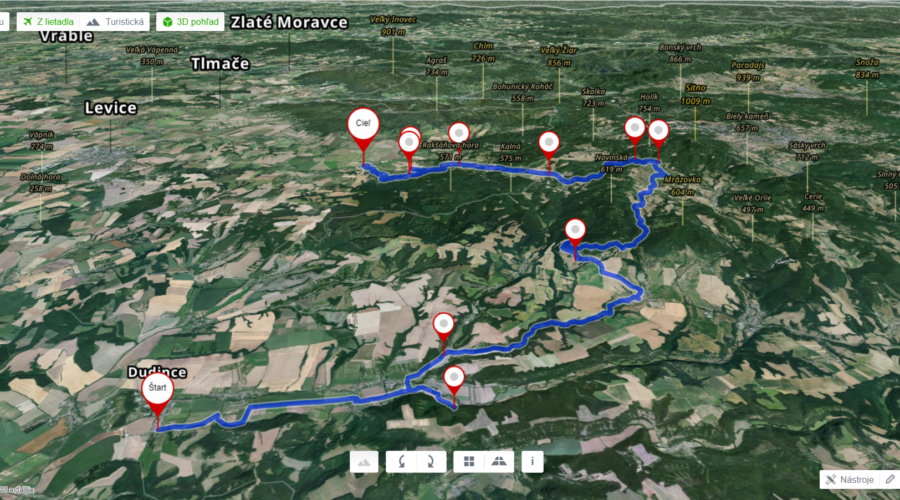
The festival route starts from Dudinice through Terany, Hontianske Tesáre, Tesárska roklina, Šipice, Sebechleby, Stará Hora, Baďan, Beluj, Jabloňovce, Pečenice and ends in Bátovce. The project promoters are using existing marked tourist routes of local importance, which will be interconnected by temporary markings. Participants will hike through small villages, meadows, and forests on the border of the Tekov and Hont regions. The route is more than 70 kilometres long with an elevation of 1079 metres.

